| 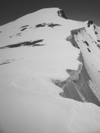
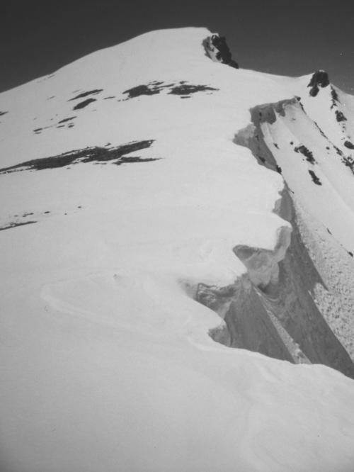
Courting the Cornice, photo by Rick Baugher.
|
The observant backcountry skier is periodically challenged, maybe even mystified, when encountering other ski tracks. Whose tracks were they? Where did they come from, where're they headed? How many in the party? Fresh or old tracks? Not exactly earth shattering stuff; it's just that in big lonely ski country there's plenty of time to wonder about such things as the nearest human being.
On 4/30/00, a clear cool sunny day, I drove to Left Fork Iron Bog Creek, in the southern Pioneer Mountains of Idaho. At 7500', after being stopped by a snowbank, began hiking. Encountered some aged snowmachine tracks, and an old white Chevy Suburban with 5B (Blaine County) license plates. Nothing out of the ordinary. Snowshoed to frozen Iron Bog Lake, then angled NNW up into a protected snowbowl, at which point I was kicking myself for not bringing skis on such a glorious day. At the 10600'+ head of this untracked bowl, seemingly out of the blue, there appeared one set of fresh ski tracks. It looked like they were headed off the precipitous east face of the mountain!
Shortly, upon reaching the summit of Iron Bog Peak el 10800' I built a small cairn and left a note on the only exposed point of rocks. From here the Pioneer Mountains winterscape dazzled the senses, while the distant plains were faintly turning green. And of course, I was turning green with envy for the mystery skier. It was only when headed back toward the Left Fork Iron Bog Road that I discovered the skier's exit point. He had indeed descended Iron Bog Peak's east face and bowl, and the 5B Suburban must have been his outfit. So, the mystery was solved in all respects but one- who was this intrepid skier?
Anticlimactically, two weeks later on 5/14/00, I returned to do my previous snowshoe route on skis. Ate lunch on the blustery summit, then 3 pin telemarked down Iron Bog Peak's south facing bowl in flat light. Ho hum, another day at the office.
Courting the Cornice at 10600'+
View W toward the summit of Iron Bog Peak on 4/30/00. Mystery Skier's tracks were strong as he flirted with this north face cornice line. Apparently tagging the summit wasn't of interest, as his descent tracks began here, a couple hundred yards shy of the top.
|
| 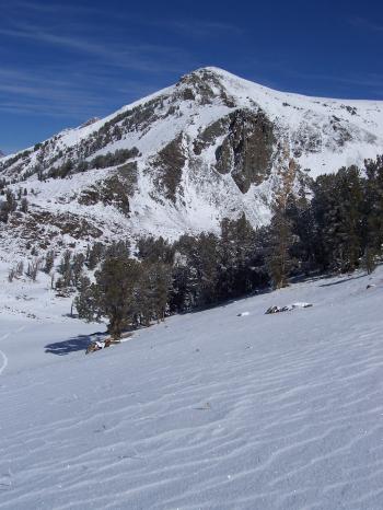
Iron Bog Peak, photo by Rick Baugher.
|
View N to Iron Bog Peak on 10/10/06. My May 2000 ski descent came down the peak's south bowl, tucked away on right side of photo.
|
| 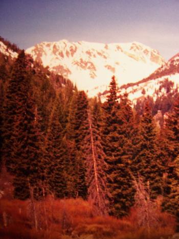
Iron Bog Peak, photo by Rick Baugher.
|
Iron Bog Peak el 10800', prom 460', has no name and no spot elevation on the Smiley Mountain quad. This view up Iron Bog Creek shows the peak's imposing east face, probably a couple of hours before it was skied on 4/30/00. On a clear day you can see this face from the foothills east of Idaho Falls, a distance of 100 miles.
RB
8B (Bonneville County)
12/17/09
|